Customize Consent Preferences

We use cookies to help you navigate efficiently and perform certain functions. You will find detailed information about all cookies under each consent category below.

The cookies that are categorized as "Necessary" are stored on your browser as they are essential for enabling the basic functionalities of the site. ... 

Always Active

Necessary cookies are required to enable the basic features of this site, such as providing secure log-in or adjusting your consent preferences. These cookies do not store any personally identifiable data.

No cookies to display.

Functional cookies help perform certain functionalities like sharing the content of the website on social media platforms, collecting feedback, and other third-party features.

No cookies to display.

Analytical cookies are used to understand how visitors interact with the website. These cookies help provide information on metrics such as the number of visitors, bounce rate, traffic source, etc.

No cookies to display.

Performance cookies are used to understand and analyze the key performance indexes of the website which helps in delivering a better user experience for the visitors.

No cookies to display.

Advertisement cookies are used to provide visitors with customized advertisements based on the pages you visited previously and to analyze the effectiveness of the ad campaigns.

No cookies to display.

Abaltzisketa Amezketa | PR: Pequeños Recorridos

Sendero Txindoki


PR-Gi 2005

← Volver a la lista de rutas
sendero txindoki


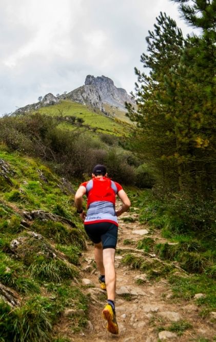
En este largo y maravilloso recorrido, vemos algunos de los diferentes tipos de paisajes que podemos encontrar en Aralar. Partiendo de la Iglesia de San Martín nos adentramos en un ambiente rural lleno de caseríos.

Después de dejar atrás el área de recreo de Larraitz, en las primeras rampas del monte Txindoki se nos presentan las comarcas de Goierri y Tolosaldea con sus pequeños núcleos de edificios, caseríos, diferentes cultivos y el embalse de Ibiur.

A medida que la presencia del Txindoki se hace mayor, asoman los pastos altos de Aralar y disfrutamos de su morfología sinuosa. Bordas de pastores rodeados de fresnos y cercados. Terminamos bajando por sendas entre pinares y robledales.


Powered by Wikiloc

Distancia
15.1 km

Duración
06:00 h

Subida
991 m

Bajada
991 m

Punto de partida
Iglesia de San Martín

MIDE

Severidad del medio natural / 2

Orientación en el itinerario / 2

Dificultad en el desplazamiento / 3

Cantidad de esfuerzo necesario / 4

También te
puede interesar...