Customize Consent Preferences

We use cookies to help you navigate efficiently and perform certain functions. You will find detailed information about all cookies under each consent category below.

The cookies that are categorized as "Necessary" are stored on your browser as they are essential for enabling the basic functionalities of the site. ... 

Always Active

Necessary cookies are required to enable the basic features of this site, such as providing secure log-in or adjusting your consent preferences. These cookies do not store any personally identifiable data.

No cookies to display.

Functional cookies help perform certain functionalities like sharing the content of the website on social media platforms, collecting feedback, and other third-party features.

No cookies to display.

Analytical cookies are used to understand how visitors interact with the website. These cookies help provide information on metrics such as the number of visitors, bounce rate, traffic source, etc.

No cookies to display.

Performance cookies are used to understand and analyze the key performance indexes of the website which helps in delivering a better user experience for the visitors.

No cookies to display.

Advertisement cookies are used to provide visitors with customized advertisements based on the pages you visited previously and to analyze the effectiveness of the ad campaigns.

No cookies to display.

Alegia Tolosa | SL: Senderos Locales

Aldabatxikimendi (completa)


SL-GI 52

← Volver a la lista de rutas
aldabatxikimendi


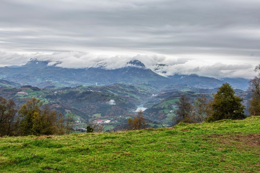
Este sendero asequible, de 7,9 Km de longitud y 483 m de desnivel, nos llevará a conocer los alrededores de Alegia.

Nada más comenzar la ruta, a la altura del final de la calle Bidebarrieta y el comienzo de Erbeta, pasaremos bajo un pequeño túnel, con el fin de salvar las vías de tren. Poco después, y tras cruzar por debajo la autovía N-1, iremos caminando entre plantaciones forestales y prados, hasta llegar cerca del caserío de Langaurrezar. A partir de aquí el camino se introduce en un pinar que nos llevará por la ladera del monte Miraleku.

Tras recorrer unos 4 km llegaremos a la parte más alta de nuestro recorrido, alcanzando los 414 metros de altitud. Poco a poco iremos descendiendo, atravesaremos la zona de Aldabamendi y llegaremos hacia la parte norte de la localidad de Alegia. Cruzaremos bajo la autovía N-1 para llegar a una zona industrial y poco después pasaremos de nuevo bajo las vías de tren, retornando a nuestro punto de partida.


Powered by Wikiloc

Distancia
7.9 km

Duración
02:15 h

Subida
514 m

Bajada
514 m

También te
puede interesar...